This is one long out-and-back hike, ideal for a weekend backpacking trip. You’ll walk through old growth rain forest and finally reach an open valley that is truly deserving of its name. It’s a long hike for a day hike (13.5 + 2.5 miles — the additional 2.5 miles is due to last bit of the Graves Creek Road having been washed out, so you have to walk that bit too), but not all that demanding: it’s slightly uphill on the way out, and gently downhill on the way back. The most difficult bit is to climb over fallen trees (trees are huge here, so you have to climb over them, not just step over them). For most of the hike you will be under a dense rain forest canopy, with only a few clearing when you get to the Quinault river bank now and again. It’s only once you reach the Enchanted Valley that the landscape opens up around you and so there is a real wow moment as you reach your destination…
How long?
2 days, 1 night
How many miles?
32 miles / 52 km
How?
Hiking + wilderness / backcountry camping
Map required, compass optional (i.e. well maintained & sign-posted trail — anyway you just have to follow the river)
Maps?
National Geographic Trails Illustrated Map #216
Itinerary:
Graves Creek trailhead -> Enchanted Valley -> Graves Creek trailhead
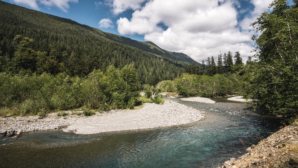
The route couldn’t be easier: from Lake Quinault, follow the South Shore Road until it becomes a dirt road and changes name to Graves Creek Road, then follow this to the end. Park your car, and follow the east fork of the Quinault river for ~15-16 miles until you get to a large-ish valley: you’ve arrived in Enchanted Valley. There is only one trail crossing, 200 yards beyond the official trailhead, where you need to take the trail to the right and that’s it — you just follow the main trail for the rest of it. You hardly need a map for this hike. You will need a backcountry permit from a ranger station, but you can get that in Quinault on your way to the trailhead. Permits are not limited for Enchanted Valley, so you will be guaranteed to get one.
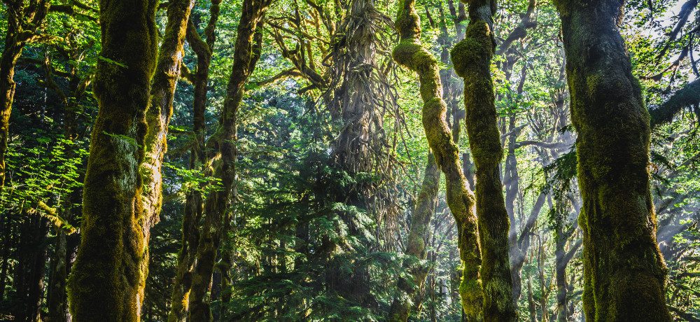
Graves Creek road has been washed out for some time now it seems and is likely to remain so for some time more. The river bed moved and claimed a short section of the road and is perilously close to the road in other parts. This now means that the trail head is essentially 2.5 miles earlier down the road, with an improvised side-of-the-road parking area and makeshift turn-around point. Graves Creek campground is now essentially a backcountry / wilderness campground and the ranger station at Graves Creek looked unmanned at the time of my visit. That said, it’s a flat 2.5 miles and pleasant enough: you have good views over the Quinault river and there are beautiful patches of moss-covered old-growth forest along the trail / dirt road.
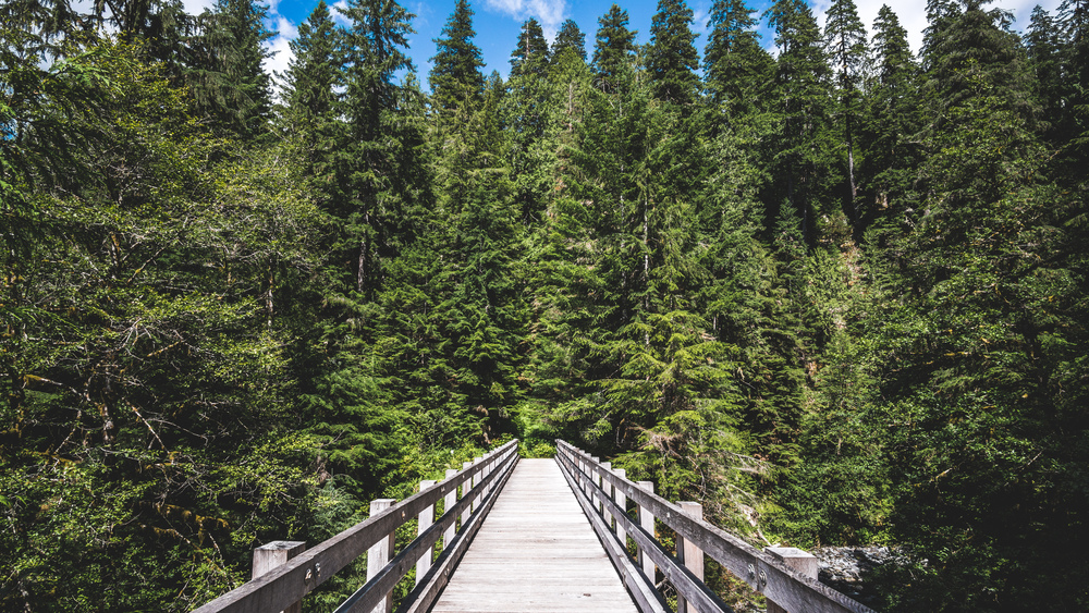
After 2 miles you will come past the Graves Creek campground and then the ranger station. The official trailhead is another half mile (maybe a little less) up the road. You cross a bridge and you are off for a 13.5 miles hike through prime Olympic rain forest.
There is not so much to say about the hike itself. It’s a straightforward affair, and to be fair, a bit repetitive after a while. You pretty much stay in the dense woodwork except for a few clearings as you get close to the river bank. When I did the hike (July 2016), ranger crews had cleared the trail up to the O’Neil camp site. For the second half of the trail to Enchanted Valley you then had to climb over fallen trees now and again, the longest bit involving crossing the Quinault river twice over fallen tree trunks. That said, I quite liked that as it added a bit of fun to the hike (the ranger at Port Angeles where I got my permit told me I would have to ford the river, but thanks to the tree trunks this was not necessary). You will hike past 3 other wilderness camp sites: Pony Bridge, Pyrites Creek and O’Neil Creek — so if you do not wish to push all the way to valley, you can set up camp there too (or split the trip into 2-3 nights…).
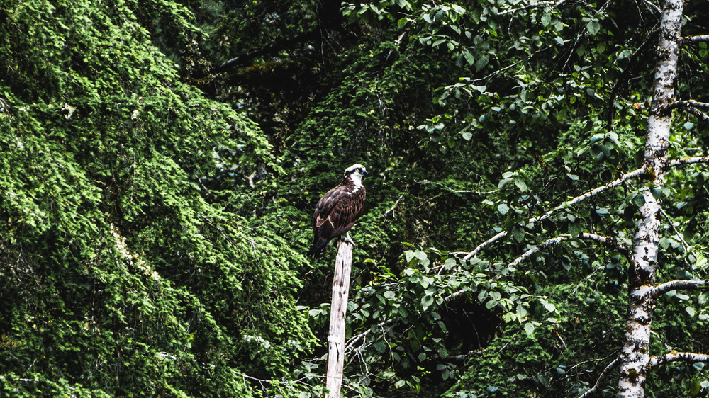
In spring this trail, and Enchanted Valley in particular, are great for bear spotting (so the ranger said) but less so in Summer. And sure enough, I did not come across any bear. There was however an osprey very actively hunting in the valley when I got there and it was quite a sight to see it soaring across the valley floor.
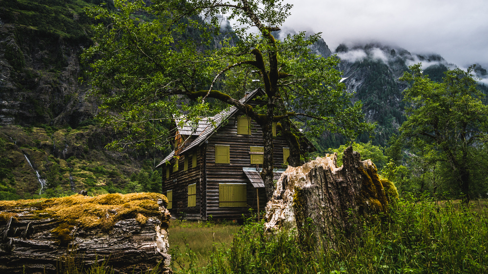
Once you are in the valley, you can pretty much pitch your tent where you want, though you really should pitch it on a previously disturbed / used camp site. I was actually surprised by how many people there were in the valley (it is a long-ish hike after all, with much less spectacular scenery than the beach or mountain hikes in Olympic NP, and the weather, overcast & grey, wasn’t so great either). Most seem to stick fairly close to the old ranger chalet, but the valley is spacious and you should be able to find a nice secluded spot out of the way of the other hikers. There are 2 pit toilets in the valley, which is nice as you do not have to do any digging and don’t have to carry out your used toilet paper. The ranger chalet is quite picturesque, and when I arrived in the evening the clouds were hugging the mountain ride opposite.
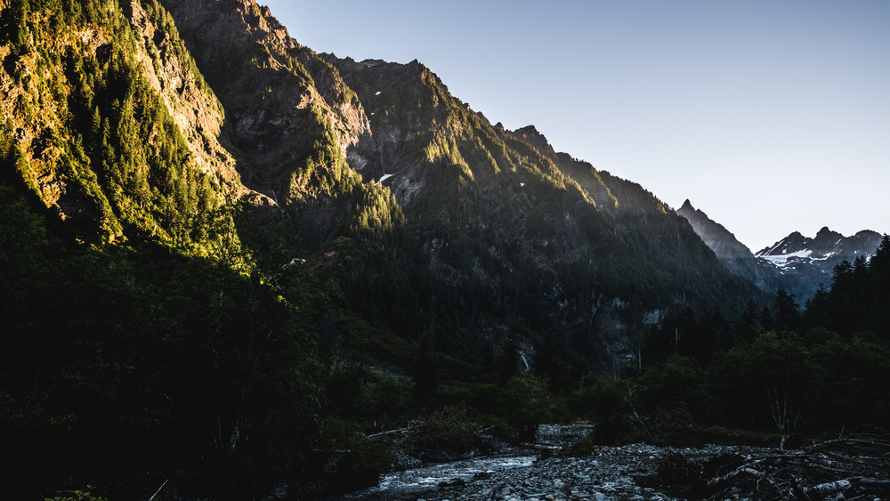
The skies cleared over night and sunrise in the valley was beautiful and spectacular. There was quite a lot of morning dew, so I had to pack up my tent wet and then dry it in the car / at home.
After a good hearty breakfast, pack you stuff and then just hike back to Graves Creek road the way you came in. Not so exciting, but if you want to make a looping hike here, it will be quite a bit longer and you’d have to plan spending 2-3 nights out in the wilderness. But it can definitely be done, but since I was only here for a weekend, it was not an option for me.
What would I do differently now that I’ve done this
I had decided against camping out on one of the beaches since I read that in summer the bugs will be fierce there at dusk and dawn and also since I read that Shi-Shi beach on a summer weekend can see as much as 100-150 people camping out there. I also decided against one of the hikes in the mountains (e.g. the hike up to the Upper Royal Basin is supposed to be amazing) as I had been out to Yosemite NP not so long ago and figured it would be similar to that, so wanted a bit of a changed of scenery. That left only the third of Olympic’s 3 ecosystems: the rain forest. Enchanted Valley seemed perfect: much of the rain forest and probably much fewer crowds than you’d get at Hoh Forest. That said this is probably not the best one-night backpacking trip you can do. The rain forest is really, really nice (just look at the cover image for this post!) but 15 miles is a lot of it, so you have enough of it after a while. The Enchanted Valley is also really, really beautiful, but still not sure if it is worth hiking several hours for (one-way took me 5h, and I was going at a decent pace!). One big reason for me to do this hike was the chance to see bears, but alas this was not meant to be. If all of this sounds quite negative, then that’s only relative. It is a really great hike with great scenery, but compared to the scenery you can get in other parts of Olympic NP it’s probably not the most scenic and spectacular.
Data files (click on the link, then download whatever format you prefer from the gpsies website):
One-way (just hike the same route back the next day): http://www.gpsies.com/map.do?fileId=ptjxwfotlnmqsaql
Comments