How long?
1/2 day (running) or 1 day (hiking)
How many miles?
15.5 miles / 25 km
(~13 miles / 21km without any detour)
How?
Trail running or hiking
Map required, compass optional (i.e. well maintained & sign-posted trails & prominent features all around; still I would carry a compass just in case)
Maps?
New York New Jersey Trail Conference Map #119
Itinerary:
Manitou rail station-> Anthony’s Nose -> Bear Mountain Bridge -> Bear Mountain -> Manitou rail station
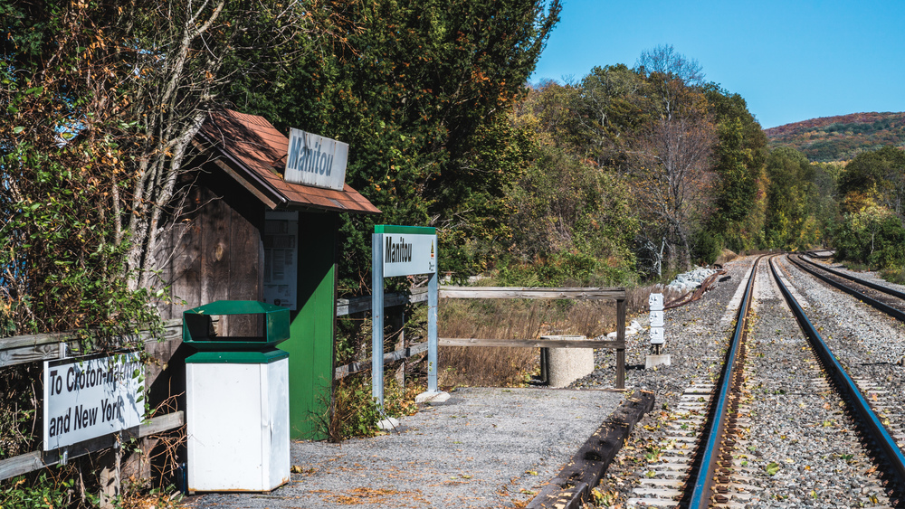
Metro North from Grand Central or 125th Street takes you from NYC to Manitou. Be sure to check that your train does indeed stop at Manitou as it is something of a request stop and you will need to be in the last 2 coaches to get off the train at Manitou (it’s just a level crossing with a shed; not really a proper train station at all).
Manitou -> Bear Mountain
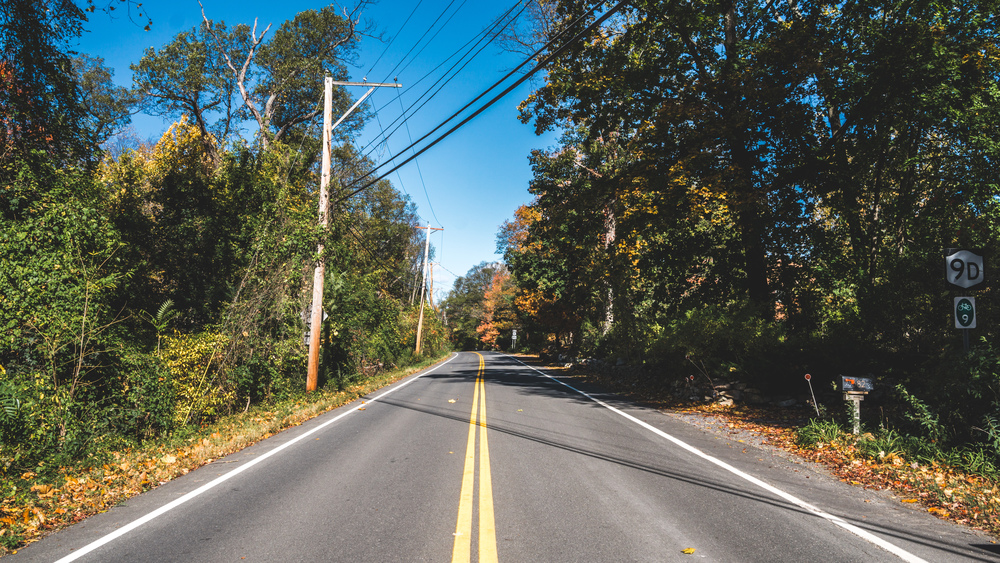
When you get off the train, you just go straight on ahead along the road (Manitou Station Road), leaving the Hudson river behind you. Cross highway 9D and follow the dirt road for 200-300 meters, then take a right onto South Mountain Pass Road and follow this for half a mile until you hit the trailhead on your right (the Appalchian Trail (AT) crosses the road here).
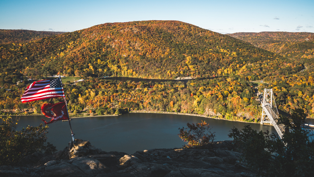
Now that you are on the trail, follow the white blazes of the AT for a bit over a mile. At the beginning the AT will follow a wood road used by the military at Camp Smith, but then will shoot off to the right at some point, very easy to miss. Anyway it’s not too bad if you do miss this turn (if you download the GPX file below, you’ll see that I missed it on my way out and only got that part correct on the way back), as you will be able to get back on the AT before it meets up with the Camp Smith Trail (blue blazes). Here the AT plunges down the mountain on the right, and this is where you will need to go to get to the Bear Mountain Bridge and Bear Mountain. However, you can do an optional out-and-back detour (0.6 miles each way) to Anthony’s Nose. If you arrived on the first train and visibility is good, I urge you do this detour now: Anthony’s Nose will become busy later in the day, and the light is best in the morning here as you are looking due west.
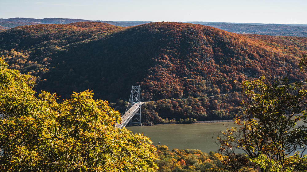
The view here is spectacular and it will give you a good idea of what is to come: you see the bridge you will cross shortly and Bear Mountain looms up before you across the Hudson.
Once you took in the view, head back to the Camp Smith Trail and AT crossing, then head down the mountain to the Bear Mountain Bridge. It’s another gorgeous American bridge, a real pleasure to cross, and the view north is breathtaking.
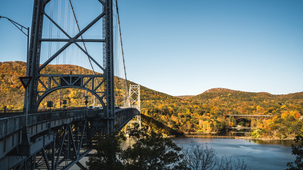
Once on the other side, cross the road and head towards the shore of Hessian Lake. From here you will be on the loop of Bear Mountain. You can go either way: clockwise, heading up Bear Mountain on the AT, then down the Major Welch Trail (MWT), or anti-clockwise with the MWT first, then the AT. The MWT is good fun as you’ll be walking over slick rock to get up (resp. down) the mountain.
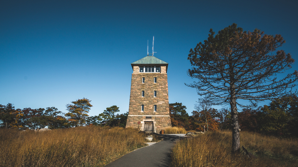
Whichever way you ascend (on this particular trip I went up the AT, down the MWT), though it’s not a very long ascent, it will knock the breath out of you and once you manage to get your sorry ass up to Perkins Tower, you will be greeted by fresh looking car drivers who haven’t really earned the gorgeous view that awaits you here.
Bear Mountain
On good visibility days you can see the Manhattan skyline (~40 miles away) in the far distance when you are standing at the main viewpoint, looking south. In fact you can see the NYC skyline on the cover image to this post above. Rapper B.o.B. once took this fact as proof that the Earth was flat, not curved and was promptly corrected by Neil DeGrasse Tyson (which did not stop him to release a song, called Flatline, about his theory and he even mentions Tyson in it).
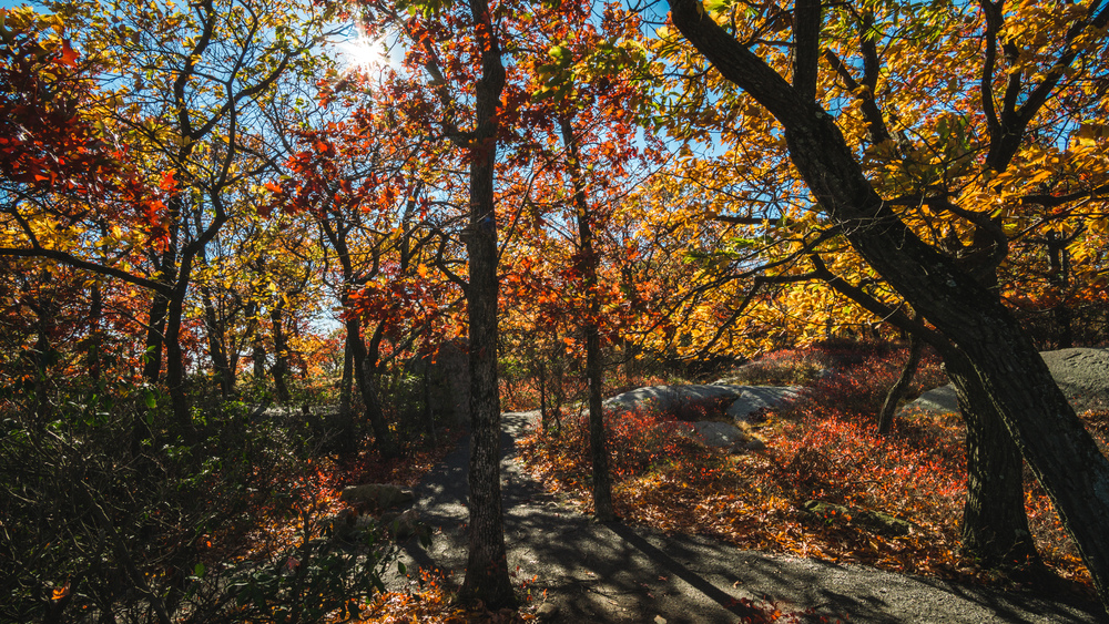
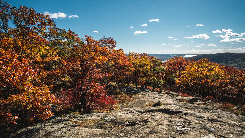
The trees and boulders on top of Bear Mountain are a delight in autumn, and particularly the top end of the MWT makes for a fine picnic spot (it’s also bit removed from all the crowds at Perkins Tower), so go for it – enjoy your lunch in nature.
On the MWT, just below the top of Bear Mountain, you will get a good view across the Hudson, looking over Bear Mountain Bridge the other way as earlier and opposite you will be Anthony’s Nose.
Bear Mountain -> Manitou
Once you completed the loop of Bear Mountain, you need to cross the Hudson again, and make the tough ascent of the AT. If you haven’t gone up to Anthony’s Nose before, you have another chance now. If you do go, there’s also a good view to be had a hundred yards south of Anthony’s Nose, along Camp Smith Trail (another good, quiet picnic spot, just a bit removed from the crowds at Anthony’s Nose). Once you are done here, you have two options: follow the Camp Smith Trail until its end, then continue along the road to Peekskill and take the train back from there. From Anthony’s Nose, this is a tough 6-7 miles. The other option is that you just head back along the Camp Smith Trail to the AT, then head back to the trailhead and then Manitou.
At Manitou, you can either head back to the station the way you came, or, if you’ve got spare time before the next train, loop back to the rail station via Manitou Point Reserve. It’s a nice detour, but not a must.
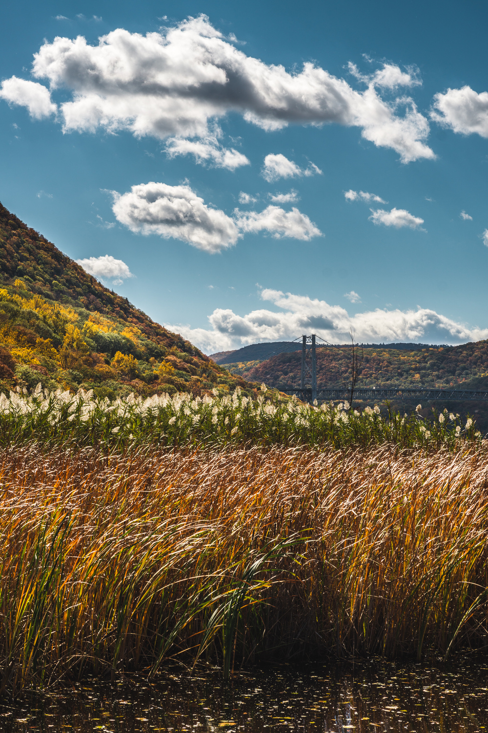
One of the finest views of the entire route is actually right at the Manitou rail station: look south across the little pond/swamp towards Bear Mountain Bridge — if the sun is out, it’s just gorgeous.
However, it’s safer to wait for the train on the other side of the rail crossing. You can actually wait for the train on a little beach on the Hudson, or else in the little shed that serves as the rail station. When the train arrives (again, make sure you checked the times beforehand as not every train stops here), everyone will need to get in through the same door. Relax for an hour on the train, enjoying the find views over the Palisades along the route, and you will be back in NYC.
Data file (click on the link, then download whatever format you prefer from the gpsies site):
Complete route (including detouring twice to Anthony’s Nose and once to Manitou Point Reserve): http://www.gpsies.com/map.do?fileId=zamewyqbxffnnpne
]]>